Property Record
73 Wilson Ave, Manalapan, NJ 07726

NEARBY LISTINGS FOR SALE OR LEASE
-
-
View all Manalapan listings for lease on LoopNet.com
Property Detail
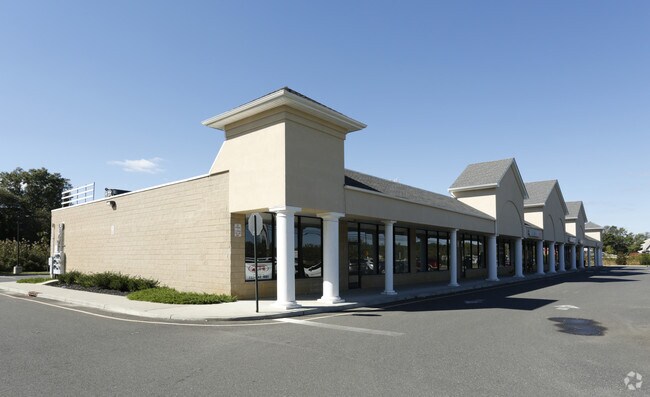
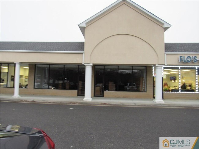
73 Wilson Ave
New York-Jersey City-White Plains, NY-NJ
MORSTAR PLAZA
28-00047-0000-00043-01
Monmouth
Regionalshoppingcenterormallwithanchorstore
New Jersey
AE
43.1
34023C0286F
11.70 AC
2024
Western Monmouth
2025
Northern New Jersey
810001
DEMOGRAPHICS near 73 Wilson Ave
1 Mile
3 Mile
5 Mile
2024 Total Population
6,226
33,729
90,534
2029 Population
6,207
33,750
89,863
Pop Growth 2024-2029
(0.31%)
+ 0.06%
(0.74%)
Average Age
39
45
45
2024 Total Households
2,088
12,035
32,627
HH Growth 2024-2029
(0.48%)
+ 0.17%
(0.94%)
Median Household Inc
$132,326
$123,330
$127,779
Avg Household Size
2.90
2.70
2.70
2024 Avg HH Vehicles
2.00
2.00
2.00
Median Home Value
$512,151
$612,092
$560,263
Median Year Built
1990
1987
1986
Nearby Places
Map Layers
Map Styles
 Street
 Aerial
- Restaurants
- Banks
- Shops
- Fitness
- Groceries
PUBLIC TRANSPORTATION
AIRPORT
Trenton Mercer
DRIVE
WALK
Distance
Trenton Mercer
52 min
31.6 mi
Newark Liberty International
DRIVE
WALK
Distance
Newark Liberty International
56 min
35.4 mi
Freight Ports
New York Container Terminal
DRIVE
WALK
Distance
New York Container Terminal
49 min
30.7 mi
SALE & LEASE HISTORY
LISTING DATE
SALE/LEASE

Sep 25, 2016
For Lease
Dec 13, 2019
For Lease
Nearby Properties
Address
Land Use
TOTAL SIZE
Lot Size
Zoning
Address
Land Use
TOTAL SIZE
Lot Size
Zoning
67.30 AC
PB
Address
Land Use
TOTAL SIZE
Lot Size
Zoning
12.10 AC
PB
Address
Land Use
TOTAL SIZE
Lot Size
Zoning
14,552 SF
484.47 AC
R20
Address
Land Use
TOTAL SIZE
Lot Size
Zoning
23.08 AC
PB
Address
Land Use
TOTAL SIZE
Lot Size
Zoning
6.97 AC
C2
Address
Land Use
TOTAL SIZE
Lot Size
Zoning
9.28 AC
MF08
Address
Land Use
TOTAL SIZE
Lot Size
Zoning
8.15 AC
C2-M
Address
Land Use
TOTAL SIZE
Lot Size
Zoning
10.25 AC
PB
Address
Land Use
TOTAL SIZE
Lot Size
Zoning
58,024 SF
9.45 AC
C2
Address
Land Use
TOTAL SIZE
Lot Size
Zoning
6.37 AC
C2
Address
Land Use
TOTAL SIZE
Lot Size
Zoning
18 AC
PB
Address
Land Use
TOTAL SIZE
Lot Size
Zoning
6.68 AC
C3
Address
Land Use
TOTAL SIZE
Lot Size
Zoning
28 AC
PB
Address
Land Use
TOTAL SIZE
Lot Size
Zoning
17.70 AC
PB
Address
Land Use
TOTAL SIZE
Lot Size
Zoning
750 SF
280.39 AC
SD5
Address
Land Use
TOTAL SIZE
Lot Size
Zoning
6.60 AC
C50
Address
Land Use
TOTAL SIZE
Lot Size
Zoning
15.26 AC
PB
Address
Land Use
TOTAL SIZE
Lot Size
Zoning
16 AC
R20
Address
Land Use
TOTAL SIZE
Lot Size
Zoning
4.04 AC
MU08
Address
Land Use
TOTAL SIZE
Lot Size
Zoning
5.54 AC
C2
Address
Land Use
TOTAL SIZE
Lot Size
Zoning
19.34 AC
PB
Address
Land Use
TOTAL SIZE
Lot Size
Zoning
9 AC
RAG4
Address
Land Use
TOTAL SIZE
Lot Size
Zoning
22.92 AC
VC-1
Address
Land Use
TOTAL SIZE
Lot Size
Zoning
23,697 SF
3.71 AC
R-LD
Address
Land Use
TOTAL SIZE
Lot Size
Zoning
41,897 SF
2.30 AC
C2M
Address
Land Use
TOTAL SIZE
Lot Size
Zoning
10.60 AC
9151
Address
Land Use
TOTAL SIZE
Lot Size
Zoning
5.31 AC
I01
Address
Land Use
TOTAL SIZE
Lot Size
Zoning
2,808 SF
9.41 AC
R20
Address
Land Use
TOTAL SIZE
Lot Size
Zoning
1.77 AC
C2
Address
Land Use
TOTAL SIZE
Lot Size
Zoning
14,928 SF
4.80 AC
C50
The World's #1 Commercial Real Estate Marketplace
Connect with us
© 2026 CoStar Group
The information above has been obtained from sources believed reliable. While we do not doubt its accuracy we have not verified it and make no guarantee, warranty or representation about it. It is your responsibility to independently confirm its accuracy and completeness. Any projections, opinions, assumptions, or estimates used are for example only and do not represent the current or future performance of the property. The value of this transaction to you depends on tax and other factors which should be evaluated by your tax, financial, and legal advisors. You and your advisors should conduct a careful, independent investigation of the property to determine to your satisfaction the suitability of the property for your needs.